 Population181,648 (2025 est.)
Riverfront Design and Lake Country With Deep Roots
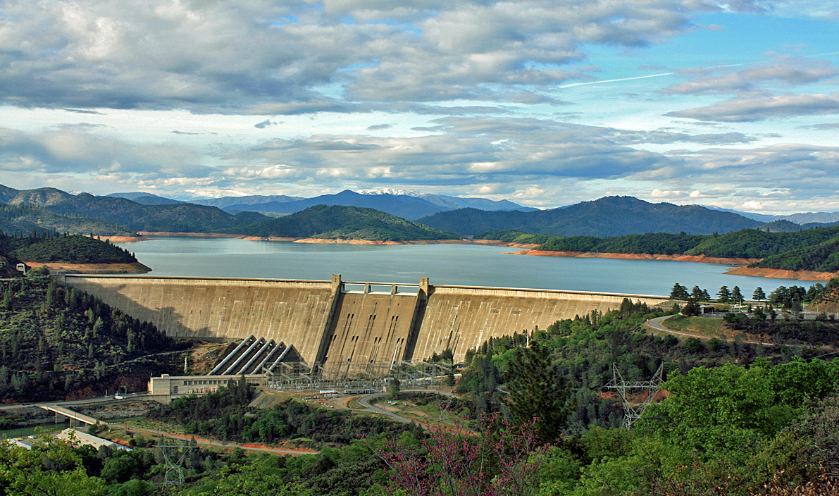
Shasta County, CaliforniaShasta County centers on Redding near the northern end of California’s Sacramento Valley, with lakes and mountain terrain extending beyond the city. The Sundial Bridge crosses the Sacramento River at Turtle Bay, connecting public art with a working pedestrian route. Whiskeytown offers another setting for outdoor exploration and local history. Despite the county’s name, Mount Shasta itself lies in neighboring Siskiyou County, an important distinction when planning a visit to the region.
Shasta County at a Glance
Population181,648 (2025 est.) County SeatRedding
 Largest cityRedding
 Established1850
 ZIP CodesSee postal resources
 Total Area, Including Water3,847 sq mi (total)
 Major RoutesInterstate 5; State Route 36; State Route 44; State Route 89; State Route 151; State Route 273
 Area CodesVaries by community
Shop - Dine - Discover

Meet Local Businesses
Support the businesses that help make our communities thrive. From family-owned shops and restaurants to trusted local services, discover businesses worth visiting throughout the county.
Discover Shasta County
Shasta County
Shasta County was established in 1850 as one of California's original counties, with later boundary changes creating parts of neighboring counties. The Whiskeytown area's history includes Wintu communities and a nineteenth-century gold-mining settlement, adding human context to today's recreation landscape. Redding now serves as the county seat. Its Sundial Bridge, opened in 2004, represents a much more recent chapter: a public structure that connects the city's riverfront with art, design and the surrounding trail system.
Start at Redding's Sundial Bridge for a close view of the Sacramento River and a connection to the river trail system. Turtle Bay's visitor information distinguishes the publicly accessible bridge from its separately managed museum and garden areas. Whiskeytown provides a different outing beyond the city, with its own visitor resources and historical interpretation. Keep Shasta Lake, Whiskeytown and Mount Shasta distinct when planning; similar regional names can refer to different destinations and counties.
What Shapes Us
A Riverfront Landmark
The Sundial Bridge connects pedestrian travel and public art across the Sacramento River, linking the two sides of Turtle Bay with Redding's riverfront trails.
Whiskeytown Histories
Wintu history and the later gold-mining settlement add human depth to Whiskeytown's recreation landscape, encouraging visitors to consider more than the water and scenery.
Know the Geography
Shasta County and Mount Shasta are different destinations: the mountain lies in Siskiyou County, while Redding anchors the county described in this guide.
Follow the river into the region's changing stories.
A Closer Look
Shasta County
Places and perspectives from Shasta County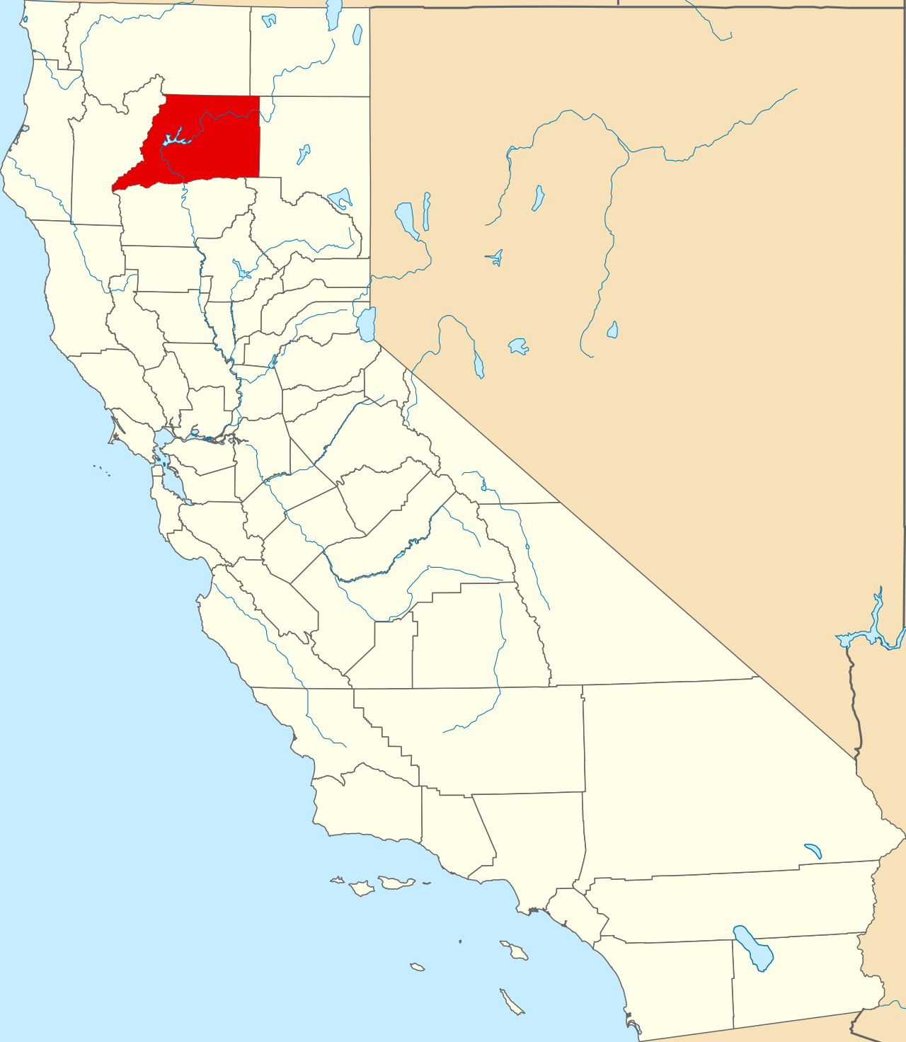
Shasta County headlines via Google News
Six arrested during 'Operation Boo' targeting sex offenders in Shasta County - KRCR
Six arrested during 'Operation Boo' targeting sex offenders in Shasta County KRCR
Read the Story Nov 2, 2026 • 2 min read
Around Shasta County
Stories from every corner of Shasta County.
Six arrested during 'Operation Boo' targeting sex offenders in Shasta County - KRCR
Six arrested during 'Operation Boo' targeting sex offenders in Shasta County KRCR
Nov 2, 2026 • 2 min read
Shasta County bat rabies cases rise — what you need to know - Action News Now
Shasta County bat rabies cases rise — what you need to know Action News Now
Nov 2, 2026 • 2 min read
6 arrested in Redding-area Halloween sex offender checks - Action News Now
6 arrested in Redding-area Halloween sex offender checks Action News Now
Nov 2, 2026 • 2 min read
Shasta County voter guide 2026: Key races, statewide propositions - Record Searchlight
Shasta County voter guide 2026: Key races, statewide propositions Record Searchlight
Nov 2, 2026 • 2 min read
Breaking: A07a Fire reported in Shasta County on Oct. 31 - Sacramento Bee
Breaking: A07a Fire reported in Shasta County on Oct. 31 Sacramento Bee
Oct 31, 2026 • 2 min read
Shop - Dine - Discover
Meet Local Businesses
Support the businesses that help make our communities thrive. From family-owned shops and restaurants to trusted local services, discover businesses worth visiting throughout the county.
County Resources
Find the Right Local Connection
Start with the organization responsible for the service you need. Follow its official link for current requirements, office locations and availability.
Government
Start with the county’s public information and department directory for local contacts and service information.
Schools
Public school contacts
Selected local schools from the NCES 2024-2025 directory. Contact the school or district to confirm enrollment, attendance boundaries and current services; this is not a complete school list.
Anderson High – High; grades 09-12. 1471 Ferry St., Anderson, CA 96007. 530-365-2741.
Bella Vista Elementary – Elementary; grades KG-08. 22661 Old Alturas Rd., Bella Vista, CA 96008. 530-549-4415.
Black Butte Elementary – Elementary; grades KG-05. 7752 Ponderosa Way, Shingletown, CA 96088. 530-474-3125.
Anderson Heights Elementary – Elementary; grades KG-05. 1530 Spruce St., Anderson, CA 96007. 530-378-7050.
Castle Rock Elementary – Elementary; grades KG-08. 29373 Main St., Castella, CA 96017. 530-235-0101.
Chrysalis Charter – Elementary; grades KG-08. 21945 Old Forty-Four Dr., Palo Cedro, CA 96073. 530-547-9726.
Columbia Elementary – Elementary; grades KG-04. 10142 Old Oregon Trail, Redding, CA 96003. 530-223-4070.
Hospitals
Local hospital contacts
Facility contacts from the CMS Hospital General Information directory, updated July 22, 2026. Contact the facility directly to confirm current services and appointment arrangements.
Mayers Memorial Hospital – Critical Access Hospitals. 43563 Hwy 299 East, Fall River Mills, CA 96028. 530-336-5511.
Mercy Medical Center Redding – Acute Care Hospitals. 2175 Rosaline Ave, Clairmont Hgts, Redding, CA 96001. 530-225-6102.
Patients' Hospital Of Redding – Acute Care Hospitals. 2900 Eureka Way, Redding, CA 96001. 530-225-8700.
Shasta Regional Medical Center – Acute Care Hospitals. 1100 Butte St, Redding, CA 96001. 530-244-5454.
Public Safety
Start with the county’s public information and department directory for local contacts and service information.
Emergency Services
Start with the county’s public information and department directory for local contacts and service information.
Parks & Public Lands
Start with the county’s public information and department directory for local contacts and service information.
Trails
Start with the county’s public information and department directory for local contacts and service information.
Utilities
Start with the county’s public information and department directory for local contacts and service information.
Libraries
Local library contacts
Locations and public phone numbers are from the IMLS FY2024 Public Libraries Survey. Call the branch to confirm current hours and services before visiting.
Redding Library – 1100 Parkview Avenue, Redding, CA 96001. 530-245-7250.
Anderson Library – 3200 W. Center St., Anderson, CA 96007. 530-365-7685.
Burney Library – 37038 Siskiyou St., Burney, CA 96013. 530-335-4317.
Courts
Start with the county’s public information and department directory for local contacts and service information.
DMV
California — Locations & Hours
California — Renew Registration
Transportation
Start with the county’s public information and department directory for local contacts and service information.
Postal Services
USPS location finder — Search by street address, city or ZIP Code for nearby post offices, collection boxes and available services.
USPS ZIP Code lookup — Find the mailing ZIP Code for a specific street address.
USPS Hold Mail — Arrange a temporary mail hold and review identity-verification requirements.
USPS change of address and forwarding — Review forwarding options and submit an address-change request through USPS.
USPS package pickup — Check pickup availability for your address and schedule eligible shipments.
Veterans
National services available to local residents
VA accredited representatives — Find help with VA claims and benefit applications.
VA health care applications — Review application options and supporting information.
VA disability claims — Find the official steps for submitting a disability claim.
GI Bill and education benefits — Review how to apply for VA education benefits.
Veteran career and employment support — Explore VA employment, training and career assistance.
Employment
National services available to local residents
USAJOBS federal employment — Search federal openings by location and occupation.
Apprenticeship Finder — Search apprenticeship opportunities by location and occupation.
My Next Move career exploration — Explore occupations, industries and career interests.
Government job-training resources — Find routes to state training programs and support for different job seekers.
Unemployment benefit guidance — Find your state program and its application and eligibility information.
Get to Know Shasta County
Useful answers for residents, visitors and anyone planning their next step.
Local Questions
Shasta County Questions, Answered
Explore practical details about the county and the organizations that serve it.
181,648 (July 1, 2025 Census estimate). This is a dated Census Bureau estimate, rather than a live resident count.
3,847.396 square miles, including water (2020 Census geography). The total combines land and water area.
No. Mount Shasta is in neighboring Siskiyou County. Redding is the seat of Shasta County; the similar names describe different places. Shasta County geographic background.
Turtle Bay identifies the bridge and surrounding river trails as free public access. Some museum, garden and other park areas have separate admission, so distinguish those from the bridge itself. Turtle Bay’s Sundial Bridge information.
Start with these official California resources: Renew DL/ID; Locations & Hours; Renew Registration. Choose the page for the service you need, then check its office or online instructions before making a trip. These links cover state services; they do not establish that every transaction is available at a county office.
Use USPS ZIP Code Lookup for the mailing ZIP Code of a specific street address. Use the USPS location finder to search for nearby postal facilities and available services. An address lookup is more useful for mailing than assuming the entire county shares one ZIP Code.
The VA explains how to find and appoint an accredited representative for benefit claims. Contact a representative to confirm availability before appointing them. For education benefits, use the GI Bill application guidance. These are national VA services available to eligible local residents, rather than a listing of county offices.
Search USAJOBS for federal positions and the Apprenticeship Finder for apprenticeship opportunities, using location filters to narrow the results. USAGov job-training guidance points to training programs and state resources. Check each listing for current availability, eligibility and application instructions; a search result does not guarantee an opening in the county.
Shasta County was established in 1850 as one of California's original counties, with later boundary changes creating parts of neighboring counties. The Whiskeytown area's history includes Wintu communities and a nineteenth-century gold-mining settlement, adding human context to today's recreation landscape. Redding now serves as the county seat. Its Sundial Bridge, opened in 2004, represents a much more recent chapter: a public structure that connects the city's riverfront with art, design and the surrounding trail system.
Start at Redding's Sundial Bridge for a close view of the Sacramento River and a connection to the river trail system. Turtle Bay's visitor information distinguishes the publicly accessible bridge from its separately managed museum and garden areas. Whiskeytown provides a different outing beyond the city, with its own visitor resources and historical interpretation. Keep Shasta Lake, Whiskeytown and Mount Shasta distinct when planning; similar regional names can refer to different destinations and counties.
The 2020 Census geography figures record 3,775.520 square miles of land and 71.876 square miles of water in Shasta County. The county’s total area includes both. These are geographic measurements for that Census vintage, not a measurement of current water levels or public recreation access.
Shop - Dine - Discover
Meet Local Businesses
Support the businesses that help make our communities thrive. From family-owned shops and restaurants to trusted local services, discover businesses worth visiting throughout the county.
My Local Guide
Local Businesses
Businesses Serving Shasta CountyExplore the businesses listed for this county.
Businesses serving Shasta County
Additional county facts: county overview and references.
Connect with local businesses.Shasta County